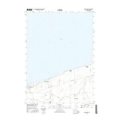
2016 Map of Sixmile Creek
USGS Topo · Published 2016About this map
Lake Ontario defines the northern reaches of this map, its shoreline punctuated by seasonal and year-round communities. Coastal settlements like Harrison Grove, Uneeda Beach, and Hopkins Beach are linked by Youngstown Wilson Rd, which runs parallel to the lakefront. Inland, the landscape transitions to the agricultural and residential areas of Porter Center and the village of Ransomville, where Ransomville Rd and Youngstown Rd intersect. The map records several family-named landmarks and local burial grounds, including Oakland Cem near the western edge and Halsted Cem further east. The drainage pattern is dominated by a series of north-flowing streams, most notably Sixmile Cr, Fourmile Cr, and the winding path of Twelvemile Cr, which meanders through the southern townships toward the lake.
Find a feature on this map
25 named features on this map. Tap any name to fly to it.
Don’t see what you’re looking for? This feature index may not catch every label — zoom into the map to look around manually.
Map Details
Editions of this 2016 Sixmile Creek Map
This is the sole edition of this map. No revisions or reprints were ever made.
Other maps of this area

1894 · Niagara Falls
USGS Topo · 1:62,500

1894 · Wilson
USGS Topo · 1:62,500

1896 · Niagara Falls
USGS Topo · 1:62,500

1897 · Tonawanda
USGS Topo · 1:62,500

1899 · Niagara
USGS Topo · 1:125,000

1900 · Wilson
USGS Topo · 1:62,500

1900 · Tonawanda
USGS Topo · 1:62,500

1900 · Niagara Falls
USGS Topo · 1:62,500

1901 · Niagara Falls
USGS Topo · 1:62,500

1901 · Tonawanda
USGS Topo · 1:62,500