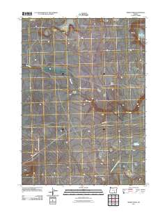
2011 Map of Sixmile Draw
USGS Topo · Published 2011About this map
Hart Mountain Antelope Refuge occupies the southwestern corner of this landscape, where the high desert terrain of Harney County is defined by seasonal water sources and volcanic features. The eponymous Sixmile Draw cuts through the center of the sheet, eventually meeting Rock Creek as it meanders toward the east. This 2011 survey reveals a remote environment where survival is tied to specific landmarks like the Murphy Waterholes, High Rim Waterhole, and Outside Waterhole. The topography is marked by distinct elevations such as Gray Buttes and the prominent Black Rim. Transportation is limited to the single arterial Frenchglen Rd, which provides access to this portion of the refuge and its surrounding ranching or conservation lands. The map illustrates the sparse, high-altitude desert characteristic of the Oregon interior, where named points of interest are almost exclusively natural features or critical water catchments.
Find a feature on this map
9 named features on this map. Tap any name to fly to it.
Don’t see what you’re looking for? This feature index may not catch every label — zoom into the map to look around manually.
Map Details
Editions of this 2011 Sixmile Draw Map
This is the sole edition of this map. No revisions or reprints were ever made.
Other maps of this area

1955 · Adel
USGS Topo · 1:250,000

1957 · Adel
USGS Topo · 1:250,000

1958 · Adel
USGS Topo · 1:250,000

1962 · Adel
USGS Topo · 1:250,000

1966 · Bluejoint Lake East
USGS Topo · 1:24,000

1967 · Flook Lake
USGS Topo · 1:24,000

1971 · Steamboat Point
USGS Topo · 1:24,000

1971 · Murphy Waterholes
USGS Topo · 1:24,000

1971 · Orejana Canyon
USGS Topo · 1:24,000
1971 · Sixmile Draw
USGS Topo · 1:24,000