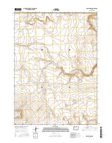
2017 Map of Sixmile Draw
USGS Topo · Published 2017About this map
Frenchglen Rd cuts diagonally across this high desert landscape, serving as the primary corridor through a region defined by seasonal drainage and volcanic terrain. In the northern reaches, the Black Rim and Gray Buttes rise as prominent geological landmarks, overlooking a network of ephemeral water sources critical to the area's land use. Strategic landmarks such as High Rim Waterhole and Outside Waterhole dot the map, indicating the vital importance of water management in this arid stretch of Harney and Lake Counties. The presence of Sixmile Draw and Rock Cr further illustrates the natural drainage patterns that have shaped the territory's ranching and transit history into the modern era.
Find a feature on this map
12 named features on this map. Tap any name to fly to it.
Don’t see what you’re looking for? This feature index may not catch every label — zoom into the map to look around manually.
Map Details
Editions of this 2017 Sixmile Draw Map
This is the sole edition of this map. No revisions or reprints were ever made.
Other maps of this area

1955 · Adel
USGS Topo · 1:250,000

1957 · Adel
USGS Topo · 1:250,000

1958 · Adel
USGS Topo · 1:250,000

1962 · Adel
USGS Topo · 1:250,000

1966 · Bluejoint Lake East
USGS Topo · 1:24,000

1967 · Flook Lake
USGS Topo · 1:24,000

1971 · Steamboat Point
USGS Topo · 1:24,000

1971 · Murphy Waterholes
USGS Topo · 1:24,000

1971 · Orejana Canyon
USGS Topo · 1:24,000
1971 · Sixmile Draw
USGS Topo · 1:24,000