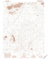
1984 Map of Skeleton Hills
USGS Topo · Published 1984About this map
The Amargosa Desert dominates this arid landscape, a region defined by extensive alluvial fans and the winding course of Rock Valley Wash. In the northern portion of the quadrangle, the Skeleton Hills rise abruptly from the desert floor, providing a stark topographical contrast to the surrounding flats. This 1984 provisional survey documents a landscape focused on resource extraction and utility infrastructure rather than settlement.
Find a feature on this map
14 named features on this map. Tap any name to fly to it.
Don’t see what you’re looking for? This feature index may not catch every label — zoom into the map to look around manually.
Map Details
Editions of this 1984 Skeleton Hills Map
2 editions found
Other maps of this area

1908 · Furnace Creek
USGS Topo · 1:250,000

1910 · Furnace Creek
USGS Topo · 1:250,000

1942 · Skull Mountain
USGS Topo · 1:125,000

1948 · Death Valley
USGS Topo · 1:250,000

1952 · Ash Meadows
USGS Topo · 1:62,500

1952 · Specter Range
USGS Topo · 1:62,500

1954 · Death Valley
USGS Topo · 1:250,000

1956 · Death Valley
USGS Topo · 1:250,000

1957 · Death Valley
USGS Topo · 1:250,000

1958 · Death Valley
USGS Topo · 1:250,000