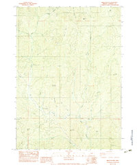
1983 Map of Skeleton Mtn
USGS Topo · Published 1983About this map
Umpqua National Forest blankets much of this northern Jackson County terrain, where the headwaters of the West Fork Applegate Creek and Evans Creek carve through the landscape. This 1980s provisional survey documents a region defined by industrial extraction and recreation, showing numerous prospects and gravel pits alongside the Elderberry Flat Recreation Site. The intricate network of drainage is marked by landmarks like Coolaway Gap and Panther Peak, while a double wooden pole powerline cuts a distinct path through the southern peaks near Battle Mountain.
Find a feature on this map
37 named features on this map. Tap any name to fly to it.
Don’t see what you’re looking for? This feature index may not catch every label — zoom into the map to look around manually.
Map Details
Editions of this 1983 Skeleton Mtn Map
This is the sole edition of this map. No revisions or reprints were ever made.
Other maps of this area

1891 · Ashland
USGS Topo · 1:250,000

1893 · Ashland
USGS Topo · 1:250,000

1897 · Ashland
USGS Topo · 1:250,000

1904 · Riddle
USGS Topo · 1:125,000

1943 · Trail
USGS Topo · 1:62,500

1944 · Tiller
USGS Topo · 1:62,500

1954 · Days Creek
USGS Topo · 1:62,500

1954 · Wimer
USGS Topo · 1:62,500

1955 · Medford
USGS Topo · 1:250,000

1957 · Medford
USGS Topo · 1:250,000