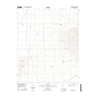
2015 Map of Skeleton Pass
USGS Topo · Published 2015About this map
The Ship Mountains rise out of the eastern Mojave Desert floor in this 2015 study, defining a landscape of arid washes and steep drainages. Central to the area is Skeleton Pass, a geographic pinch point that serves as a corridor for travel through the surrounding high ground. The presence of Danby Airstrip and Pipeline Rd underscores the sparse but functional human infrastructure developed to navigate and manage this desert expanse. Drainage patterns are dominated by Watson Wash to the north and deep cuts like Carbonate Gulch, Scanlon Gulch, and Rattlesnake Canyon. These features illustrate the erosion-carved character of the mountains, which transition abruptly into the alluvial plains where Danby Rd and Skeleton Pass Rd provide the primary transit routes.
Find a feature on this map
15 named features on this map. Tap any name to fly to it.
Don’t see what you’re looking for? This feature index may not catch every label — zoom into the map to look around manually.
Map Details
Editions of this 2015 Skeleton Pass Map
This is the sole edition of this map. No revisions or reprints were ever made.
Other maps of this area

1942 · Amboy
USGS Topo · 1:250,000

1943 · Amboy
USGS Topo · 1:250,000

1943 · Essex
USGS Topo · 1:62,500

1943 · Danby
USGS Topo · 1:62,500

1943 · Cadiz Lake
USGS Topo · 1:62,500

1954 · Needles
USGS Topo · 1:250,000

1956 · Needles
USGS Topo · 1:250,000

1956 · Milligan
USGS Topo · 1:62,500

1956 · Essex
USGS Topo · 1:62,500

1956 · Cadiz Lake
USGS Topo · 1:62,500