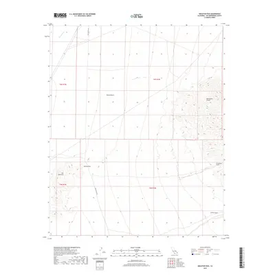
2018 Map of Skeleton Pass
USGS Topo · Published 2018About this map
Mojave Desert terrain dominates this survey of a remote section of San Bernardino County, where the topography is defined by the sharp rise of the Ship Mountains in the west and the deep incisions of Rattlesnake Canyon to the east. The arid landscape is bridged by Skeleton Pass Rd, which winds through its namesake Skeleton Pass, providing a vital transit corridor through the basin. This route traces a path between the drainage of Watson Wash and the rugged eastern slopes leading toward Carbonate Gulch. The map records a classic high-desert environment where natural landmarks like Scanlon Gulch serve as the primary identifiers in an area largely devoid of formal settlements.
Find a feature on this map
12 named features on this map. Tap any name to fly to it.
Don’t see what you’re looking for? This feature index may not catch every label — zoom into the map to look around manually.
Map Details
Editions of this 2018 Skeleton Pass Map
This is the sole edition of this map. No revisions or reprints were ever made.
Other maps of this area

1942 · Amboy
USGS Topo · 1:250,000

1943 · Amboy
USGS Topo · 1:250,000

1943 · Essex
USGS Topo · 1:62,500

1943 · Danby
USGS Topo · 1:62,500

1943 · Cadiz Lake
USGS Topo · 1:62,500

1954 · Needles
USGS Topo · 1:250,000

1956 · Needles
USGS Topo · 1:250,000

1956 · Milligan
USGS Topo · 1:62,500

1956 · Essex
USGS Topo · 1:62,500

1956 · Cadiz Lake
USGS Topo · 1:62,500