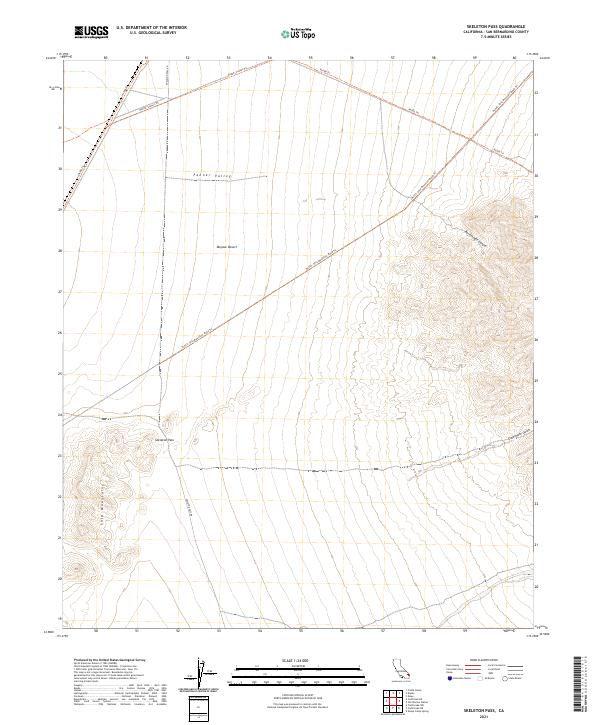
2021 Map of Skeleton Pass
USGS Topo · Published 2021About this map
Fenner Valley and the Mojave Desert converge in this arid corridor of San Bernardino County. The landscape is defined by the sharp transition from the broad alluvial floor to the rising elevations of the Ship Mountains in the southwest. A network of historical transit routes, such as Skeleton Pass Rd and the Sunset Trl, cross the valley, following natural topographic breaks like Skeleton Pass. These trails and unimproved roads suggest a history of crossing this desert expanse, where water drainage has carved prominent features like Rattlesnake Canyon and Carbonate Gulch into the surrounding highlands. The mapping reflects a modern era of desert management and recreation where designated trails like the Ship Mountain Road Trl provide the primary access to the backcountry.
Find a feature on this map
15 named features on this map. Tap any name to fly to it.
Don’t see what you’re looking for? This feature index may not catch every label — zoom into the map to look around manually.
Map Details
Editions of this 2021 Skeleton Pass Map
This is the sole edition of this map. No revisions or reprints were ever made.
Other maps of this area

1942 · Amboy
USGS Topo · 1:250,000

1943 · Amboy
USGS Topo · 1:250,000

1943 · Essex
USGS Topo · 1:62,500

1943 · Danby
USGS Topo · 1:62,500

1943 · Cadiz Lake
USGS Topo · 1:62,500

1954 · Needles
USGS Topo · 1:250,000

1956 · Needles
USGS Topo · 1:250,000

1956 · Milligan
USGS Topo · 1:62,500

1956 · Essex
USGS Topo · 1:62,500

1956 · Cadiz Lake
USGS Topo · 1:62,500