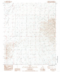
1985 Map of Skeleton Pass
USGS Topo · Published 1985About this map
Skeleton Pass serves as a critical desert corridor between the towering Old Woman Mountains and the Ship Mountains in this mid-1980s topographic study. The landscape is defined by its arid drainage patterns, including the broad Schuyler Wash that cuts through the Fenner Valley in the northwest. In the northeastern corner, the Wheel of Fortune Mine is situated high in the mountain slopes, while scattered Prospect sites and the Tanks Pumping Sta indicate the region's sparse industrial infrastructure. The map documents a network of 4wd tracks that provide the only access through this desolate terrain, tracing routes through Rattlesnake Canyon and near the steep walls of Carbonate Gulch.
Find a feature on this map
13 named features on this map. Tap any name to fly to it.
Don’t see what you’re looking for? This feature index may not catch every label — zoom into the map to look around manually.
Map Details
Editions of this 1985 Skeleton Pass Map
This is the sole edition of this map. No revisions or reprints were ever made.
Other maps of this area

1942 · Amboy
USGS Topo · 1:250,000

1943 · Amboy
USGS Topo · 1:250,000

1943 · Essex
USGS Topo · 1:62,500

1943 · Danby
USGS Topo · 1:62,500

1943 · Cadiz Lake
USGS Topo · 1:62,500

1954 · Needles
USGS Topo · 1:250,000

1956 · Needles
USGS Topo · 1:250,000

1956 · Milligan
USGS Topo · 1:62,500

1956 · Essex
USGS Topo · 1:62,500

1956 · Cadiz Lake
USGS Topo · 1:62,500