Loading...
Loading map...1981 Map of Skidmore
USGS Topo · Published 1982About this map
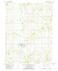
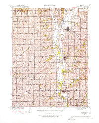
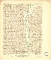
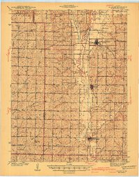
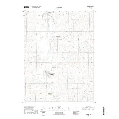
The Nodaway River dominates this Missouri landscape, winding south through the townships of Green and Monroe. The town of Skidmore serves as a local hub, situated just east of the river where the Burlington Northern Railroad Grade parallels the water's edge. North of town, the small community of Quitman sits near the confluence of the river and Bowman Branch.
Find a feature on this map
21 named features on this map. Tap any name to fly to it.
Don’t see what you’re looking for? This feature index may not catch every label — zoom into the map to look around manually.
Map Details
Date Portrayed1981
Date Published1982
PublisherU.S. Geological Survey
Map TypeTopographic
Scale1:24,000
Physical Dimensions21.9 x 26.9 inches
Editions of this 1981 Skidmore Map
This is the sole edition of this map. No revisions or reprints were ever made.
Historical Maps of Skidmore Through Time
8 maps found
Featured Locations
- Green Township, MO
- Hughes Township, MO
- Monroe Township, MO
- Quitman, Green Township
- Skidmore, Monroe Township
Source Details
SourceU.S. Geological Survey
CopyrightPublic Domain