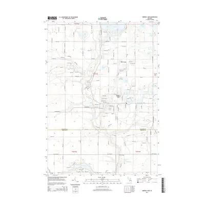
2014 Map of Skidway Lake
USGS Topo · Published 2014About this map
The settlement of Skidway Lake serves as the central hub of this northern Michigan landscape, where a dense network of residential streets meets the winding path of the Rifle River. This 2014 survey reveals an intricate glacial hydrology characterized by dozens of small lakes and kettle ponds, including Lake Ogemaw, Norway Lake, and Elbow Lake. The map details the transition from the structured street grids of the township to the wilder drainage systems of Feeding Ground Cr and Mills Cr. Genealogists and local historians will find the Mills Cem and Moffatt Bridge as key landmarks within the Ogemaw and Arenac County borderlands. The interplay of named trails like Pontiac Trl and Ogemaw Trl against water bodies such as Boughner Lake and Hardwood Lake illustrates the region's character as a residential and recreational woods-and-water environment.
Find a feature on this map
149 named features on this map. Tap any name to fly to it.
Don’t see what you’re looking for? This feature index may not catch every label — zoom into the map to look around manually.
Map Details
Editions of this 2014 Skidway Lake Map
This is the sole edition of this map. No revisions or reprints were ever made.
Other maps of this area

1954 · Traverse City
USGS Topo · 1:250,000

1954 · Tawas City
USGS Topo · 1:250,000

1958 · Traverse City
USGS Topo · 1:250,000

1958 · Tawas City
USGS Topo · 1:250,000

1965 · West Branch
USGS Topo · 1:24,000

1965 · Selkirk
USGS Topo · 1:24,000

1968 · Prescott
USGS Topo · 1:24,000

1968 · Sage Lake
USGS Topo · 1:24,000
1968 · Omer SW
USGS Topo · 1:24,000

1968 · Sterling
USGS Topo · 1:24,000