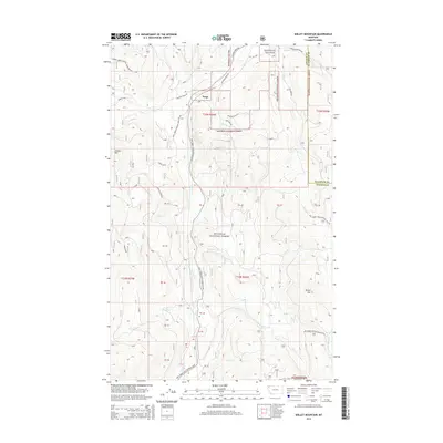
2014 Map of Skillet Mountain
USGS Topo · Published 2014About this map
Trego serves as the primary point of settlement on this 2014 survey of northwestern Montana, situated where the Swamp Cr Rd and Fortine Creek Rd intersect. The landscape is defined by the dense forest management zones of the Kootenai National Forest, which covers the majority of the quadrangle. Significant drainages like Fortine Cr and Swamp Cr carve through the high terrain, which is punctuated by prominent landmarks such as Swamp Mtn and Skillet Mtn.
Find a feature on this map
40 named features on this map. Tap any name to fly to it.
Don’t see what you’re looking for? This feature index may not catch every label — zoom into the map to look around manually.
Map Details
Editions of this 2014 Skillet Mountain Map
This is the sole edition of this map. No revisions or reprints were ever made.
Other maps of this area

1913 · Stryker
USGS Topo · 1:125,000

1916 · Stryker
USGS Topo · 1:125,000

1920 · Jennings
USGS Topo · 1:125,000

1935 · Thompson Lakes
USGS Topo · 1:96,000

1942 · Thompson Lakes
USGS Topo · 1:125,000

1957 · Kalispell
USGS Topo · 1:250,000

1960 · Kalispell
USGS Topo · 1:250,000

1961 · Kalispell
USGS Topo · 1:250,000

1963 · Davis Mountain
USGS Topo · 1:24,000

1963 · Warland Peak
USGS Topo · 1:24,000