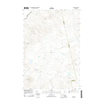
2014 Map of Skinner
USGS Topo · Published 2014About this map
Skinner and Keough are the primary points of settlement within this wooded borderland of Somerset County, situated near the international boundary between Maine and Canada. The landscape is defined by the complex hydrology of the Moose River and its various tributaries, including the South Branch Moose River and Indian Brook. These waterways are punctuated by numerous small bodies of water such as Sipun Pond, Sapet Pond, and Twin Island Pond.
Find a feature on this map
33 named features on this map. Tap any name to fly to it.
Don’t see what you’re looking for? This feature index may not catch every label — zoom into the map to look around manually.
Map Details
Editions of this 2014 Skinner Map
This is the sole edition of this map. No revisions or reprints were ever made.
Other maps of this area

1923 · Attean
USGS Topo · 1:62,500

1925 · Attean
USGS Topo · 1:62,500

1928 · Chain Lakes
USGS Topo · 1:48,000

1928 · Skinner
USGS Topo · 1:48,000

1928 · Spencer
USGS Topo · 1:48,000

1931 · Skinner
USGS Topo · 1:62,500

1932 · Spencer
USGS Topo · 1:62,500

1932 · Chain Lakes
USGS Topo · 1:62,500

1935 · Chain Lakes
USGS Topo · 1:62,500

1949 · Jackman
USGS Topo · 1:250,000
Featured Places
- Holeb Township, ME
- Gorham Gore, ME
- Lowelltown Township, ME
- Skinner, Lowelltown Township
- Skinner Township, ME