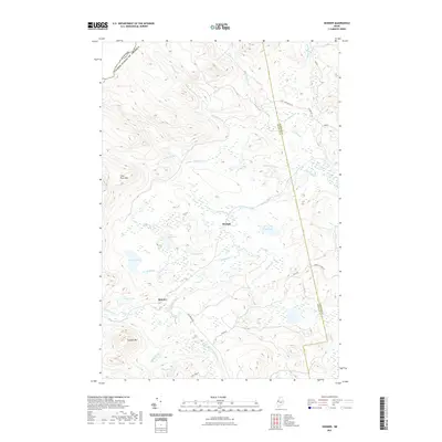
2021 Map of Skinner
USGS Topo · Published 2021About this map
The Canada United States of America border defines the northwestern edge of this wilderness landscape, where the headwaters of the Moose River and the South Branch Moose River converge. Settlement is concentrated at the small outposts of Skinner and Keough, situated along the river corridors. The surrounding terrain is characterized by high peaks such as Clear Pond Mtn and Caswell Mtn, interspersed with numerous high-altitude ponds including Oqim Pond, Sipun Pond, and Elaine Pond. A network of logging roads, such as Goldbrook Rd and Holeb Rd, provides access through the heavy timber of the Franklin and Somerset County border region. This geography illustrates a remote Maine interior dominated by water systems like the Gulf Stream and Little Gulf Stream, where human activity is inextricably tied to the natural drainages and mountain passes.
Find a feature on this map
31 named features on this map. Tap any name to fly to it.
Don’t see what you’re looking for? This feature index may not catch every label — zoom into the map to look around manually.
Map Details
Editions of this 2021 Skinner Map
This is the sole edition of this map. No revisions or reprints were ever made.
Other maps of this area

1923 · Attean
USGS Topo · 1:62,500

1925 · Attean
USGS Topo · 1:62,500

1928 · Chain Lakes
USGS Topo · 1:48,000

1928 · Skinner
USGS Topo · 1:48,000

1928 · Spencer
USGS Topo · 1:48,000

1931 · Skinner
USGS Topo · 1:62,500

1932 · Spencer
USGS Topo · 1:62,500

1932 · Chain Lakes
USGS Topo · 1:62,500

1935 · Chain Lakes
USGS Topo · 1:62,500

1949 · Jackman
USGS Topo · 1:250,000
Featured Places
- Holeb Township, ME
- Gorham Gore, ME
- Lowelltown Township, ME
- Skinner, Lowelltown Township
- Skinner Township, ME