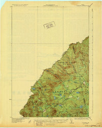
1931 Map of Skinner
USGS Topo · Published 1931About this map
The international border between the Canada United States defines the western edge of this 1928 survey, where the dense timberlands of the North Maine Woods meet the Quebec frontier. The Canadian Pacific railway cuts a diagonal path through the township of Lowelltown, serving as the primary artery for remote outposts like the station at Lowelltown and the cluster of Summit Camps near the height of land. This region, dominated by the headwaters of the Moose River, was an active landscape of logging and sporting camps during the early twentieth century, evidenced by the presence of Hogans Camp and numerous named ponds such as Indian Pond and Clear Pond. Prominent peaks like Dome Mtn and Caswell Mtn overlook a complex network of waterways including the Gulf Stream and Little Smith Brook, illustrating the challenging logistics of the era's regional rail-and-river economy.
Find a feature on this map
29 named features on this map. Tap any name to fly to it.
Don’t see what you’re looking for? This feature index may not catch every label — zoom into the map to look around manually.
Map Details
Editions of this 1931 Skinner Map
3 editions found
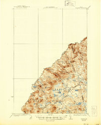
Other maps of this area

1923 · Attean
USGS Topo · 1:62,500

1925 · Attean
USGS Topo · 1:62,500

1927 · Sandy Bay
USGS Topo · 1:48,000

1928 · Chain Lakes
USGS Topo · 1:48,000

1928 · Skinner
USGS Topo · 1:48,000

1928 · Spencer
USGS Topo · 1:48,000

1930 · Sandy Bay
USGS Topo · 1:62,500

1931 · Skinner
USGS Topo · 1:62,500

1932 · Spencer
USGS Topo · 1:62,500

1932 · Arnold Pond
USGS Topo · 1:48,000