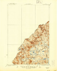
1931 Map of Skinner
USGS Topo · Published 1944About this map
Skinner and Lowelltown anchor this remote borderland survey, where the Canadian Pacific railroad cuts through the northern Maine wilderness. The landscape is defined by the zigzagging Canada United States boundary line, marking the divide between Quebec and Franklin County. Extensive timber and transit networks are evident through the presence of a Tote Road and seasonal outposts such as Hogans Camp and Summit Camps.
Find a feature on this map
38 named features on this map. Tap any name to fly to it.
Don’t see what you’re looking for? This feature index may not catch every label — zoom into the map to look around manually.
Map Details
Editions of this 1931 Skinner Map
3 editions found
Other maps of this area

1923 · Attean
USGS Topo · 1:62,500

1925 · Attean
USGS Topo · 1:62,500

1927 · Sandy Bay
USGS Topo · 1:48,000

1928 · Chain Lakes
USGS Topo · 1:48,000

1928 · Skinner
USGS Topo · 1:48,000

1928 · Spencer
USGS Topo · 1:48,000

1930 · Sandy Bay
USGS Topo · 1:62,500

1931 · Skinner
USGS Topo · 1:62,500

1932 · Spencer
USGS Topo · 1:62,500

1932 · Arnold Pond
USGS Topo · 1:48,000