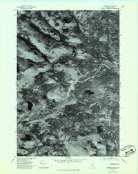
1977 Map of Skinner
USGS Topo · Published 1983About this map
Moose River meanders through the heart of this Maine-Quebec borderlands orthophotoquad, a landscape defined by its complex drainage network and dense forest cover. The 1977 aerial imagery reveals the isolated settlements of Keough and Skinner, appearing as small clearings within the timberland. These outposts sit along the river's path, reflecting the historic reliance on watercourses for transportation and industry in the North Woods.
Find a feature on this map
10 named features on this map. Tap any name to fly to it.
Don’t see what you’re looking for? This feature index may not catch every label — zoom into the map to look around manually.
Map Details
Editions of this 1977 Skinner Map
This is the sole edition of this map. No revisions or reprints were ever made.
Other maps of this area

1923 · Attean
USGS Topo · 1:62,500

1925 · Attean
USGS Topo · 1:62,500

1928 · Chain Lakes
USGS Topo · 1:48,000

1928 · Skinner
USGS Topo · 1:48,000

1928 · Spencer
USGS Topo · 1:48,000

1931 · Skinner
USGS Topo · 1:62,500

1932 · Spencer
USGS Topo · 1:62,500

1932 · Chain Lakes
USGS Topo · 1:62,500

1935 · Chain Lakes
USGS Topo · 1:62,500

1949 · Jackman
USGS Topo · 1:250,000