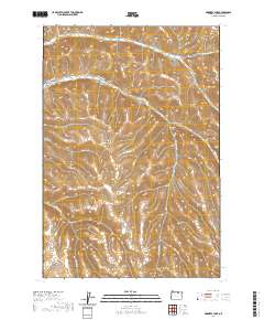
2020 Map of Skinners Fork
USGS Topo · Published 2020About this map
Skinners Fork and the deeply incised drainage systems of Morrow County define this high-elevation landscape. The terrain is a complex network of seasonal watercourses and steep-walled canyons, including Stingel Canyon and Stalter Canyon, which cut through the high plateau. The map shows a region shaped by natural erosion and livestock ranching infrastructure, where water management is critical to the local economy.
Find a feature on this map
25 named features on this map. Tap any name to fly to it.
Don’t see what you’re looking for? This feature index may not catch every label — zoom into the map to look around manually.
Map Details
Editions of this 2020 Skinners Fork Map
This is the sole edition of this map. No revisions or reprints were ever made.
Other maps of this area

1953 · Pendleton
USGS Topo · 1:250,000

1956 · Pendleton
USGS Topo · 1:250,000

1967 · Freezeout Ridge
USGS Topo · 1:24,000

1968 · Swaggart Buttes
USGS Topo · 1:24,000

1968 · Lena
USGS Topo · 1:24,000

1968 · Gleason Butte
USGS Topo · 1:24,000

1968 · Heppner
USGS Topo · 1:24,000

1968 · Skinners Fork
USGS Topo · 1:24,000

1969 · Summerfield Ridge
USGS Topo · 1:24,000

1969 · Arbuckle Mtn
USGS Topo · 1:24,000