
1971 Map of Skinnerton
USGS Topo · Published 1974About this map
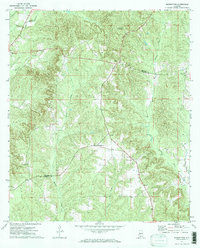
Skinnerton and the surrounding pine-clad hills of the coastal plain were documented in detail during the early 1970s. This rural landscape on the border of Monroe and Conecuh Counties is defined by a network of winding waterways, most notably Murder Creek and the West Sepulga River. The map reveals a community-focused settlement pattern anchored by numerous rural churches, such as Savanna Ch and New Hope Ch, alongside scattered homesteads connected by unpaved roads and forest tracks. A prominent landmark of the era is the McWilliams Lookout Tower, which surveyed the timberlands from a high point in the northeast. Small hamlets like Riley and Midway serve as the primary nodes of activity in this quiet, timber-producing region, showing the continuity of local land use and family settlements before more modern development reached the area.
Find a feature on this map
17 named features on this map. Tap any name to fly to it.
Don’t see what you’re looking for? This feature index may not catch every label — zoom into the map to look around manually.
Map Details
Editions of this 1971 Skinnerton Map
2 editions found
Other maps of this area

1953 · Andalusia
USGS Topo · 1:250,000

1957 · Andalusia
USGS Topo · 1:250,000

1967 · Beatrice
USGS Topo · 1:24,000

1971 · Lyeffion
USGS Topo · 1:24,000

1971 · China
USGS Topo · 1:24,000

1971 · Burnt Corn
USGS Topo · 1:24,000

1971 · Bethel
USGS Topo · 1:24,000

1971 · Beatrice
USGS Topo · 1:24,000
1981 · Nadawah
USGS Topo · 1:24,000
1981 · Mc Williams
USGS Topo · 1:24,000