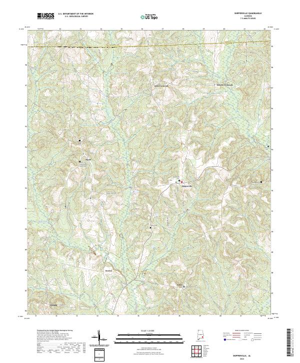
2024 Map of Skipperville
USGS Topo · Published 2024About this map
The rolling landscape of Dale County south of the Barbour County line is defined by a network of rural crossroads and historic congregations. Skipperville serves as a primary local node, surrounded by small settlements like Arguta and Beamon. The area is notably dense with community burial grounds that provide deep roots for genealogical research, including the Union Presbyterian Church Cem, Pleasant Ridge Cem, and Antioch Cem.
Find a feature on this map
43 named features on this map. Tap any name to fly to it.
Don’t see what you’re looking for? This feature index may not catch every label — zoom into the map to look around manually.
Map Details
Editions of this 2024 Skipperville Map
This is the sole edition of this map. No revisions or reprints were ever made.
Other maps of this area

1942 · Enterprise
USGS Topo · 1:125,000

1948 · Ozark
USGS Topo · 1:62,500

1950 · Ozark
USGS Topo · 1:62,500

1953 · Dothan
USGS Topo · 1:250,000

1954 · Dothan
USGS Topo · 1:250,000

1955 · Dothan
USGS Topo · 1:250,000

1960 · Ewell
USGS Topo · 1:24,000
1960 · Ozark
USGS Topo · 1:24,000
1962 · Ewell
USGS Topo · 1:25,000
1969 · Elamville
USGS Topo · 1:24,000