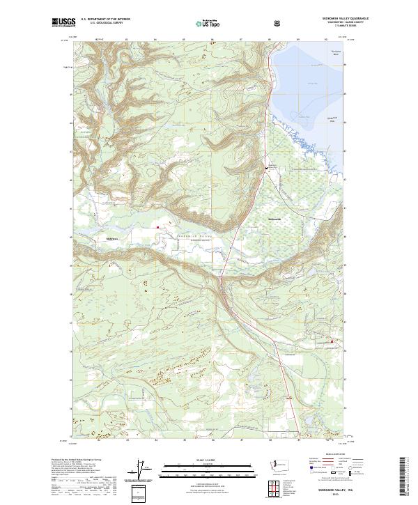
2023 Map of Skokomish Valley
USGS Topo · Published 2023About this map
The Skokomish River dominates this landscape as it flows through the Skokomish Valley toward The Great Bend of the Hood Canal. This modern survey details the intricate relationship between the river's delta and the surrounding Mason County terrain, including the Skokomish Flats and the protected lands of the Olympic National Forest. The settlement of Skokomish is a central point of interest, featuring the Skokomish Indian Cem and several community roads such as N Tribal Center Rd and N Agency Rd. To the west, the smaller community of Mohrweis sits near Hunter Creek. The map provides a clear view of the complex hydrology of the region, from the North Fork Skokomish River to the upland lakes like Stevens Lake and Rose Lake, and the southern wetlands near Kent Lake and Woelfel Lake.
Find a feature on this map
74 named features on this map. Tap any name to fly to it.
Don’t see what you’re looking for? This feature index may not catch every label — zoom into the map to look around manually.
Map Details
Editions of this 2023 Skokomish Valley Map
This is the sole edition of this map. No revisions or reprints were ever made.
Other maps of this area

1939 · Shelton
USGS Topo · 1:62,500

1943 · Potlatch
USGS Topo · 1:62,500

1943 · Nahwatzel Lake
USGS Topo · 1:62,500

1952 · Potlatch
USGS Topo · 1:62,500

1953 · Mt Tebo
USGS Topo · 1:62,500

1953 · Shelton
USGS Topo · 1:62,500

1953 · Elma
USGS Topo · 1:62,500

1958 · Seattle
USGS Topo · 1:250,000

1962 · Seattle
USGS Topo · 1:250,000
1981 · Nahwatzel Lake
USGS Topo · 1:24,000