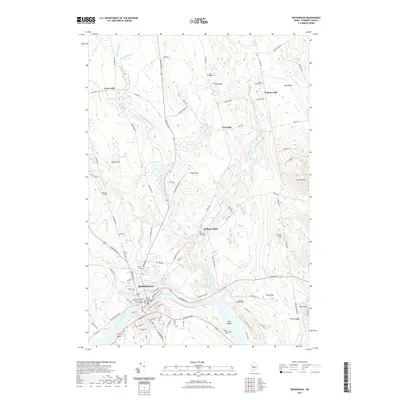
2021 Map of Skowhegan
USGS Topo · Published 2021About this map
The Kennebec River carves through this Somerset County landscape, defining the character of Skowhegan at the river’s sharp bend. This modern survey illustrates the enduring importance of the waterway, highlighting the Great Eddy and the clustered legal and civic infrastructure of the Somerset County Superior Court. North of the town center, the terrain rises into the prominent ridges of West Ridge and East Ridge, where small agricultural and residential pockets like Cornville sit among the headwaters of Wesserunsett Stream.
Find a feature on this map
96 named features on this map. Tap any name to fly to it.
Don’t see what you’re looking for? This feature index may not catch every label — zoom into the map to look around manually.
Map Details
Editions of this 2021 Skowhegan Map
This is the sole edition of this map. No revisions or reprints were ever made.
Other maps of this area

1892 · Waterville
USGS Topo · 1:62,500

1894 · Norridgewock
USGS Topo · 1:62,500

1898 · Norridgewock
USGS Topo · 1:62,500

1904 · Anson
USGS Topo · 1:62,500

1913 · Skowhegan
USGS Topo · 1:62,500

1943 · Norridgewock
USGS Topo · 1:62,500

1943 · Waterville
USGS Topo · 1:62,500

1948 · Bangor
USGS Topo · 1:250,000

1955 · Anson
USGS Topo · 1:62,500

1955 · Skowhegan
USGS Topo · 1:62,500