1913 Map of Skowhegan
USGS Topo · Published 1941About this map
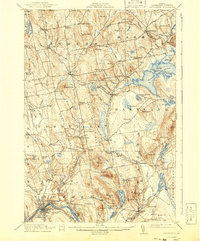
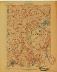
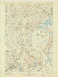
The Kennebec River defines the southwestern corner of this survey, where the regional hub of Skowhegan serves as the focal point for commerce and transport. The Maine Central RR runs through the valley, connecting the town’s industry to broader markets. Beyond the river, the landscape transitions into a network of small farming communities and timber-related sites, including Malbons Mills and Waltons Mill. Local education and social life are anchored by numerous neighborhood schools, such as the Revere School and Dudley School, and the centrally located Union Church.
Find a feature on this map
120 named features on this map. Tap any name to fly to it.
Don’t see what you’re looking for? This feature index may not catch every label — zoom into the map to look around manually.
Map Details
Editions of this 1913 Skowhegan Map
4 editions found
Other maps of this area

1892 · Waterville
USGS Topo · 1:62,500

1894 · Norridgewock
USGS Topo · 1:62,500

1898 · Norridgewock
USGS Topo · 1:62,500

1903 · Bingham
USGS Topo · 1:62,500

1904 · Anson
USGS Topo · 1:62,500

1905 · Bingham
USGS Topo · 1:62,500

1913 · Skowhegan
USGS Topo · 1:62,500

1926 · Burnham
USGS Topo · 1:62,500

1930 · Pittsfield
USGS Topo · 1:48,000

1932 · Pittsfield
USGS Topo · 1:62,500