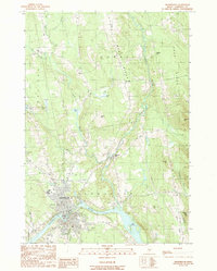
1989 Map of Skowhegan
USGS Topo · Published 1989About this map
The Kennebec River bends sharply through Skowhegan, defining the industrial and social heart of this Somerset County region during the late 1980s. The landscape reflects a transition from traditional water-powered industry to modern recreation and commerce, evidenced by the presence of Waltons Mill and Lower Mill alongside a Drive-In Theater and a local Trailer Park. Significant elevation changes are marked by Eaton Mtn and Stafford Ridge to the east, while the village of Malbons Mills sits near the confluence of several small brooks.
Find a feature on this map
40 named features on this map. Tap any name to fly to it.
Don’t see what you’re looking for? This feature index may not catch every label — zoom into the map to look around manually.
Map Details
Editions of this 1989 Skowhegan Map
This is the sole edition of this map. No revisions or reprints were ever made.
Other maps of this area

1892 · Waterville
USGS Topo · 1:62,500

1894 · Norridgewock
USGS Topo · 1:62,500

1898 · Norridgewock
USGS Topo · 1:62,500

1904 · Anson
USGS Topo · 1:62,500

1913 · Skowhegan
USGS Topo · 1:62,500

1943 · Norridgewock
USGS Topo · 1:62,500

1943 · Waterville
USGS Topo · 1:62,500

1948 · Bangor
USGS Topo · 1:250,000

1955 · Anson
USGS Topo · 1:62,500

1955 · Skowhegan
USGS Topo · 1:62,500