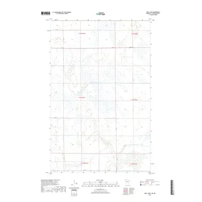
2019 Map of Skull Lake
USGS Topo · Published 2019About this map
McKinley Cem stands in the northern reaches of this Kittson County landscape, a vital point of reference for genealogists researching families of the far northwest corner of Minnesota. The terrain is defined by a meticulous system of water management, illustrated by the presence of State Ditch Number Eightyfour and State Ditch Number Eightyfive, which cut across the prairie to manage the low-lying wetlands. The natural course of the N Br Two Rivers meanders through the southern sections, contrasting with the rigid grid of the Public Land Survey System. A network of rural routes, including Co Rd 51 and 360th St, provides access to the scattered farms and fields that characterize this late-20th-century agricultural region near the Canadian border.
Find a feature on this map
18 named features on this map. Tap any name to fly to it.
Don’t see what you’re looking for? This feature index may not catch every label — zoom into the map to look around manually.
Map Details
Editions of this 2019 Skull Lake Map
This is the sole edition of this map. No revisions or reprints were ever made.
Other maps of this area

1918 · Hemmington
USGS Topo · 1:62,500

1941 · Hallock
USGS Topo · 1:62,500

1952 · Thief River Falls
USGS Topo · 1:250,000

1956 · Thief River Falls
USGS Topo · 1:250,000

1957 · Thief River Falls
USGS Topo · 1:250,000

1966 · Skull Lake
USGS Topo · 1:24,000

1966 · Skull Lake NE
USGS Topo · 1:24,000

1966 · Skull Lake SE
USGS Topo · 1:24,000
1966 · Skull Lake SW
USGS Topo · 1:24,000

1967 · Thief River Falls
USGS Topo · 1:250,000