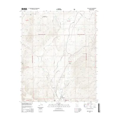
2014 Map of Skull Valley
USGS Topo · Published 2014About this map
Skull Valley serves as the central hub of this Arizona landscape, positioned where the drainage of Skull Valley Wash meets a complex network of ranch roads and canyons. The terrain transitions from the high elevations of the Prescott National Forest, where features like Spruce Canyon and Brushy Mtn dominate the eastern and western horizons, down to the alluvial basins. The map details a semi-arid environment defined by intermittent water sources, including Weed Canyon, Tonto Wash, and Logan Wash, alongside numerous localized livestock tanks like Young Tank and D One Tank. Of particular interest is the Yav Pe Ma Ta Airport, a small airstrip located near the southern edge of the valley, and the maze of named access routes such as S Iron Springs Rd and Copper Basin Rd that trace the historical movement through these canyons. The naming of Dead Mule Canyon and Coughran Canyon provides a window into the local ranching and topographic history of the region.
Find a feature on this map
46 named features on this map. Tap any name to fly to it.
Don’t see what you’re looking for? This feature index may not catch every label — zoom into the map to look around manually.
Map Details
Editions of this 2014 Skull Valley Map
This is the sole edition of this map. No revisions or reprints were ever made.
Other maps of this area

1887 · Prescott
USGS Topo · 1:250,000

1892 · Prescott
USGS Topo · 1:250,000

1903 · Congress
USGS Topo · 1:125,000

1904 · Congress
USGS Topo · 1:125,000

1947 · Iron Springs
USGS Topo · 1:62,500

1947 · Kirkland
USGS Topo · 1:62,500

1947 · Sheridan Mountain
USGS Topo · 1:62,500

1948 · Sheridan Mountain
USGS Topo · 1:63,360

1948 · Iron Springs
USGS Topo · 1:63,360

1948 · Kirkland
USGS Topo · 1:63,360