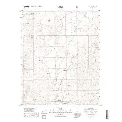
2018 Map of Skull Valley
USGS Topo · Published 2018About this map
Prescott National Forest dominates the high desert and rugged interior of this central Arizona landscape, providing a backdrop for the community of Skull Valley. The terrain is defined by a series of north-south drainage systems, most notably Skull Valley Wash and its various tributaries like Woolsey Wash and Gardener Wash. These watercourses have historically dictated the placement of ranch roads and settlement patterns, seen here in the network of routes including Ferguson Valley Rd and Webb Ranch Rd.
Find a feature on this map
54 named features on this map. Tap any name to fly to it.
Don’t see what you’re looking for? This feature index may not catch every label — zoom into the map to look around manually.
Map Details
Editions of this 2018 Skull Valley Map
This is the sole edition of this map. No revisions or reprints were ever made.
Other maps of this area

1887 · Prescott
USGS Topo · 1:250,000

1892 · Prescott
USGS Topo · 1:250,000

1903 · Congress
USGS Topo · 1:125,000

1904 · Congress
USGS Topo · 1:125,000

1947 · Iron Springs
USGS Topo · 1:62,500

1947 · Kirkland
USGS Topo · 1:62,500

1947 · Sheridan Mountain
USGS Topo · 1:62,500

1948 · Sheridan Mountain
USGS Topo · 1:63,360

1948 · Iron Springs
USGS Topo · 1:63,360

1948 · Kirkland
USGS Topo · 1:63,360