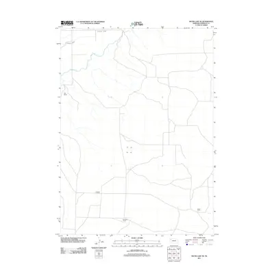
2011 Map of Skunk Lake NE
USGS Topo · Published 2011About this map
The Niobrara River winds through this section of Sheridan County, shaping a landscape defined by cattle ranching and early plains settlement. Ranching history is central to this area, anchored by the Sandoz Ranch in the southeast and the Orr Ranch Airport to the south. These family-named sites, alongside the Neely Flat Cemetery, provide essential touchpoints for genealogists and local historians tracing the heritage of the Nebraska panhandle. The presence of the Sturgeon Lateral in the north suggests the critical role of irrigation and water management in this high-plains environment. Rising above the surrounding flats, Box Butte serves as a prominent natural landmark in a region where the vast, open geography is punctuated only by occasional watercourses and a network of rural roads connecting isolated ranching operations.
Find a feature on this map
8 named features on this map. Tap any name to fly to it.
Don’t see what you’re looking for? This feature index may not catch every label — zoom into the map to look around manually.
Map Details
Editions of this 2011 Skunk Lake NE Map
This is the sole edition of this map. No revisions or reprints were ever made.
Other maps of this area

1948 · Twin Lakes
USGS Topo · 1:62,500

1950 · Twin Lakes
USGS Topo · 1:62,500

1950 · Skunk Lake
USGS Topo · 1:62,500

1955 · Alliance
USGS Topo · 1:250,000

1957 · Alliance
USGS Topo · 1:250,000

1958 · Alliance
USGS Topo · 1:250,000

1960 · Hay Springs SW
USGS Topo · 1:24,000

1960 · Hay Springs SE
USGS Topo · 1:24,000

1966 · Rushville SW
USGS Topo · 1:24,000
1985 · Gordon
USGS Topo · 1:100,000