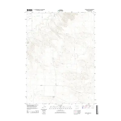
2014 Map of Skunk Lake NE
USGS Topo · Published 2014About this map
The Niobrara River winds through the northern portion of this Sheridan County landscape, defining a terrain shaped by water management and ranching operations. Significant local infrastructure is centered around the Orr Ranch and its associated Orr Ranch Airport, illustrating the scale of aviation and agriculture in this part of the Nebraska Sandhills. For those researching family history or local land use, the Neely Flat Cem provides a specific point of genealogical interest located south of the river. The map also documents a network of rural routes such as 400TH Ln and 370th Rd, alongside irrigation features like the Sturgeon Lateral and Sturgeon Drain, which highlight the intensive management of water resources required for the region's productivity.
Find a feature on this map
13 named features on this map. Tap any name to fly to it.
Don’t see what you’re looking for? This feature index may not catch every label — zoom into the map to look around manually.
Map Details
Editions of this 2014 Skunk Lake NE Map
This is the sole edition of this map. No revisions or reprints were ever made.
Other maps of this area

1948 · Twin Lakes
USGS Topo · 1:62,500

1950 · Twin Lakes
USGS Topo · 1:62,500

1950 · Skunk Lake
USGS Topo · 1:62,500

1955 · Alliance
USGS Topo · 1:250,000

1957 · Alliance
USGS Topo · 1:250,000

1958 · Alliance
USGS Topo · 1:250,000

1960 · Hay Springs SW
USGS Topo · 1:24,000

1960 · Hay Springs SE
USGS Topo · 1:24,000

1966 · Rushville SW
USGS Topo · 1:24,000
1985 · Gordon
USGS Topo · 1:100,000