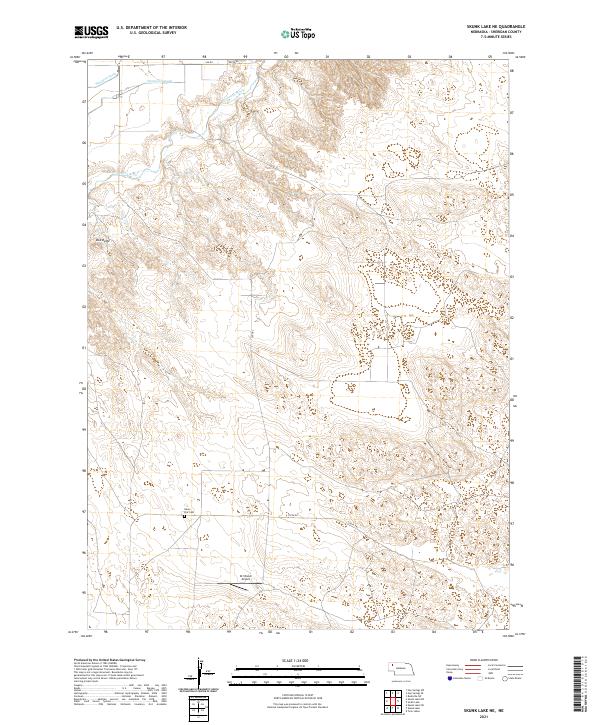
2021 Map of Skunk Lake NE
USGS Topo · Published 2021About this map
The Niobrara River winds through the northwestern reaches of this Sheridan County landscape, where water management is defined by the Sturgeon Lateral and Sturgeon Drain. The terrain transitions from the river valley into the distinct high-ground features of Box Butte and the level expanse of Neely Flat. This area of the Nebraska panhandle reflects a sparse, ranch-driven settlement pattern characteristic of the early 21st century, with large landholdings like the Orr Ranch serving as local hubs. Transportation and infrastructure are focused on the private Orr Ranch Airport and a grid of rural routes including 370th Rd and 440th Rd. For those researching local history or genealogy, the Neely Flat Cem stands as a primary point of interest, marking the endurance of early families in this remote prairie environment.
Find a feature on this map
17 named features on this map. Tap any name to fly to it.
Don’t see what you’re looking for? This feature index may not catch every label — zoom into the map to look around manually.
Map Details
Editions of this 2021 Skunk Lake NE Map
This is the sole edition of this map. No revisions or reprints were ever made.
Other maps of this area

1948 · Twin Lakes
USGS Topo · 1:62,500

1950 · Twin Lakes
USGS Topo · 1:62,500

1950 · Skunk Lake
USGS Topo · 1:62,500

1955 · Alliance
USGS Topo · 1:250,000

1957 · Alliance
USGS Topo · 1:250,000

1958 · Alliance
USGS Topo · 1:250,000

1960 · Hay Springs SW
USGS Topo · 1:24,000

1960 · Hay Springs SE
USGS Topo · 1:24,000

1966 · Rushville SW
USGS Topo · 1:24,000
1985 · Gordon
USGS Topo · 1:100,000