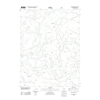
2012 Map of Skunk Ridge
USGS Topo · Published 2012About this map
Burke Ranch sits along the upper reaches of Nelson Cr in this high-elevation corner of Shasta County. The landscape is defined by its dramatic drainage systems, including the complex forks of E Fork Nelson Cr and the erosion patterns visible at the Yellow Slides and Nelson Creek Slides. This modern survey illustrates how forest access routes like Summit Lake RD and Forest Rte 37n30 navigate the steep terrain between Skunk Ridge and the peaks of North Red Mountain and Red Mountain. At the southern edge, the map captures the northern tip of Pit Four Reservoir, indicating the area's role in the regional hydroelectric network. The numerous named creeks, such as Rough and Ready Cr and Poison Cr, carve deep into the plateau near Snow Camp and Squaw Flat.
Find a feature on this map
46 named features on this map. Tap any name to fly to it.
Don’t see what you’re looking for? This feature index may not catch every label — zoom into the map to look around manually.
Map Details
Editions of this 2012 Skunk Ridge Map
This is the sole edition of this map. No revisions or reprints were ever made.
Other maps of this area

1886 · Lassen Peak
USGS Topo · 1:250,000

1886 · Modoc Lava Bed
USGS Topo · 1:250,000

1892 · Modoc Lava-Bed
USGS Topo · 1:250,000

1892 · Lassen Peak
USGS Topo · 1:250,000

1894 · Lassen Peak
USGS Topo · 1:250,000

1932 · Bartle
USGS Topo · 1:96,000

1935 · Burney
USGS Topo · 1:96,000

1939 · Burney
USGS Topo · 1:125,000

1939 · Bartle
USGS Topo · 1:125,000

1954 · Alturas
USGS Topo · 1:250,000