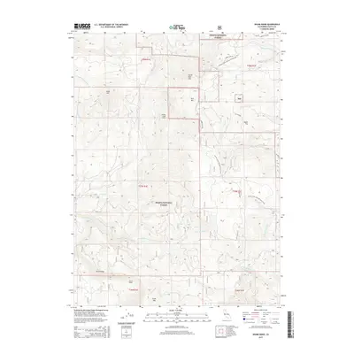
2015 Map of Skunk Ridge
USGS Topo · Published 2015About this map
The Pacific Crest National Scenic Trail winds through this high-elevation landscape in the Shasta National Forest, following the ridgelines and drainages of the southern Cascades. The terrain is defined by dramatic peaks and geological instability, evidenced by the large Nelson Creek Slides and Yellow Slides along the western slopes. Multiple mountain summits dominate the topography, including North Red Mtn, Red Mtn, Bald Mtn, and the distinctive Chalk Mtn to the south. A complex network of watercourses, such as Peavine Cr and Rock Cr, carves through the forest, while Summit Lake Rd provides one of the few vehicular access points into this protected wilderness. The map also captures several unusual hydrologic features like Underground Cr and the uniquely named Screwdriver Cr.
Find a feature on this map
31 named features on this map. Tap any name to fly to it.
Don’t see what you’re looking for? This feature index may not catch every label — zoom into the map to look around manually.
Map Details
Editions of this 2015 Skunk Ridge Map
This is the sole edition of this map. No revisions or reprints were ever made.
Other maps of this area

1886 · Lassen Peak
USGS Topo · 1:250,000

1886 · Modoc Lava Bed
USGS Topo · 1:250,000

1892 · Modoc Lava-Bed
USGS Topo · 1:250,000

1892 · Lassen Peak
USGS Topo · 1:250,000

1894 · Lassen Peak
USGS Topo · 1:250,000

1932 · Bartle
USGS Topo · 1:96,000

1935 · Burney
USGS Topo · 1:96,000

1939 · Burney
USGS Topo · 1:125,000

1939 · Bartle
USGS Topo · 1:125,000

1954 · Alturas
USGS Topo · 1:250,000