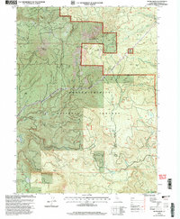
1998 Map of Skunk Ridge
USGS Topo · Published 2003About this map
Shasta Trinity National Forest encompasses the high-elevation terrain of this 1998 survey, where the Pacific Crest National Scenic Trail traverses the eastern ridges. The landscape is defined by its dramatic volcanic and tectonic topography, ranging from the heights of North Red Mountain and Bald Mountain down to the distinct geologic features of the Nelson Creek Slides and Yellow Slides.
Find a feature on this map
27 named features on this map. Tap any name to fly to it.
Don’t see what you’re looking for? This feature index may not catch every label — zoom into the map to look around manually.
Map Details
Editions of this 1998 Skunk Ridge Map
This is the sole edition of this map. No revisions or reprints were ever made.
Other maps of this area

1886 · Lassen Peak
USGS Topo · 1:250,000

1886 · Modoc Lava Bed
USGS Topo · 1:250,000

1892 · Modoc Lava-Bed
USGS Topo · 1:250,000

1892 · Lassen Peak
USGS Topo · 1:250,000

1894 · Lassen Peak
USGS Topo · 1:250,000

1932 · Bartle
USGS Topo · 1:96,000

1935 · Burney
USGS Topo · 1:96,000

1939 · Burney
USGS Topo · 1:125,000

1939 · Bartle
USGS Topo · 1:125,000

1954 · Alturas
USGS Topo · 1:250,000