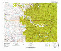
1975 Map of Skykomish River
USGS Topo · Published 1977About this map
The Skykomish River and Snoqualmie River valleys anchor this mid-1970s survey, revealing a landscape defined by industrial transport and alpine wilderness. Major transportation arteries including the Burlington Northern and the Chicago Milwaukee St Paul and Pacific railroads parallel the riverbanks, connecting established settlements like Monroe, Sultan, and Gold Bar to the high mountain passes. The map documents significant engineering feats like the Cascade Tunnel and its predecessor, the Old Cascade Tunnel, while also marking local institutions such as State Reformatory Farm No 2 near the Cherry Valley. In the eastern high country, the Pacific Crest National Scenic Trail winds through the Glacier Peak Wilderness, bridging the boundaries of the Mt Baker National Forest, Snoqualmie National Forest, and Wenatchee National Forest. This era shows the region balanced between its timber and rail heritage and its growing role as a gateway to the Cascades, with landmark peaks like Mount Si and Baring Mountain framing the river basins.
Find a feature on this map
179 named features on this map. Tap any name to fly to it.
Don’t see what you’re looking for? This feature index may not catch every label — zoom into the map to look around manually.
Map Details
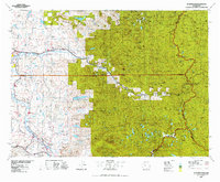
Editions of this 1975 Skykomish River Map
2 editions found
Other maps of this area

1895 · Snohomish
USGS Topo · 1:125,000

1897 · Mount Stuart
USGS Topo · 1:125,000

1897 · Tacoma
USGS Topo · 1:125,000

1897 · Seattle
USGS Topo · 1:125,000

1899 · Glacier Peak
USGS Topo · 1:125,000

1899 · Stillaguamish
USGS Topo · 1:125,000

1900 · Tacoma
USGS Topo · 1:125,000

1901 · Glacier Peak
USGS Topo · 1:125,000

1901 · Stilaguamish
USGS Topo · 1:125,000

1901 · Chiwaukum
USGS Topo · 1:125,000