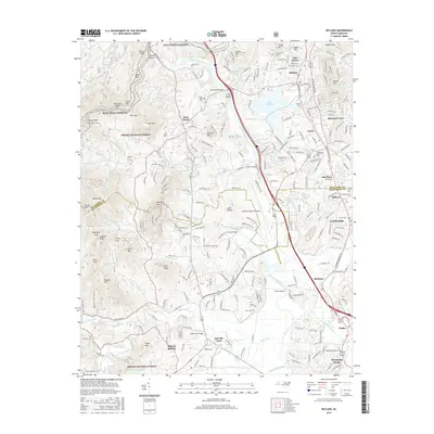
2016 Map of Skyland
USGS Topo · Published 2016About this map
The French Broad River winds through this landscape south of Asheville, where industrial and aviation development meets the protected wilds of the Pisgah National Forest. The geography is defined by a series of prominent peaks and gaps, including Forge Mtn and Grassy Knob, the latter of which is pierced by the Grassy Knob Tunnel. Near the center of the sheet, the Asheville Regional Airport occupies a broad flat between the river and the rising hills. Historically significant settlements like Mills River, Arden, and Skyland serve as anchors for the local community, while the Blue Ridge Parkway traces the high ridges to the north. For genealogists and local historians, several family-named burial sites are preserved here, including Long Shoals Cem and Whitaker Cem. The map illustrates the transition from the dense residential pockets of Oak Forest and Mountain View to the river-bottom agriculture and mountain terrain that characterize this portion of Western North Carolina.
Find a feature on this map
88 named features on this map. Tap any name to fly to it.
Don’t see what you’re looking for? This feature index may not catch every label — zoom into the map to look around manually.
Map Details
Editions of this 2016 Skyland Map
This is the sole edition of this map. No revisions or reprints were ever made.
Other maps of this area

1894 · Asheville
USGS Topo · 1:125,000

1900 · Mount Mitchell
USGS Topo · 1:125,000

1901 · Asheville
USGS Topo · 1:125,000

1902 · Mount Mitchell
USGS Topo · 1:125,000

1905 · Pisgah
USGS Topo · 1:125,000

1906 · Pisgah
USGS Topo · 1:125,000

1907 · Saluda
USGS Topo · 1:125,000

1935 · Horse Shoe
USGS Topo · 1:24,000

1935 · Hendersonville
USGS Topo · 1:24,000

1935 · Pisgah Forest
USGS Topo · 1:24,000