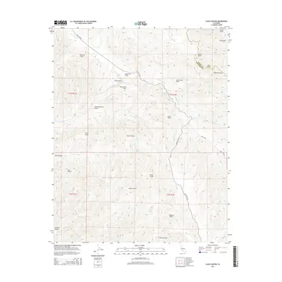
2015 Map of Slack Canyon
USGS Topo · Published 2015About this map
The San Andreas Fault cuts a distinct NW-SE diagonal through this portion of the Diablo Range, creating a complex landscape of valleys and ridges along the boundary of Fresno and Monterey Counties. This tectonic feature largely dictates the local drainage and topography, with Peachtree Valley and Pancho Rico Valley running parallel to the fault line. The area is characterized by numerous seasonal water sources and named springs such as McMillan Spring, Little Bitterwater Spring, and Brock Springs, which were critical for ranching in this arid environment. Roads like Peach Tree Rd and Indian Valley Rd follow the natural contours of the primary valleys, connecting remote canyon networks including Slack Canyon and Little Bitterwater Canyon. The map reveals a sparsely populated terrain where the geometry of the Public Land Survey System overlays a geology-driven landscape of deep canyons and high ridges.
Find a feature on this map
47 named features on this map. Tap any name to fly to it.
Don’t see what you’re looking for? This feature index may not catch every label — zoom into the map to look around manually.
Map Details
Editions of this 2015 Slack Canyon Map
This is the sole edition of this map. No revisions or reprints were ever made.
Other maps of this area

1915 · Priest Valley
USGS Topo · 1:125,000

1919 · San Miguel
USGS Topo · 1:62,500

1919 · Bradley
USGS Topo · 1:62,500

1941 · Priest Valley
USGS Topo · 1:62,500

1941 · San Ardo
USGS Topo · 1:62,500

1941 · Bradley
USGS Topo · 1:62,500

1943 · San Ardo
USGS Topo · 1:62,500

1944 · Priest Valley
USGS Topo · 1:62,500

1947 · San Luis Obispo
USGS Topo · 1:250,000

1947 · San Miguel
USGS Topo · 1:62,500