
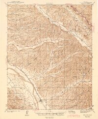
1943 Map of San Ardo
USGS Topo · Published 1943About this map
The Salinas River valley in the early 1940s is defined by the high-velocity corridor of the Southern Pacific railroad and the Camino Real, anchoring the settlement of San Ardo. This area, part of the San Bernardo (Spreckels) land grant, shows a landscape transitioning from the river bottom to the deeply dissected ridges of the Diablo Range. To the northeast, the map documents the remote Peachtree Valley and Long Valley, where seasonal drainages like Peach Tree Creek carve through the uplifted terrain.
Find a feature on this map
40 named features on this map. Tap any name to fly to it.
Don’t see what you’re looking for? This feature index may not catch every label — zoom into the map to look around manually.
Map Details
Editions of this 1943 San Ardo Map
2 editions found
Other maps of this area

1912 · San Ardo
USGS Topo · 1:31,680

1915 · Priest Valley
USGS Topo · 1:125,000

1919 · San Miguel
USGS Topo · 1:62,500

1919 · King City
USGS Topo · 1:62,500

1919 · Bryson
USGS Topo · 1:62,500

1919 · Bradley
USGS Topo · 1:62,500

1921 · Metz
USGS Topo · 1:62,500

1939 · King City
USGS Topo · 1:62,500

1940 · Metz
USGS Topo · 1:62,500

1941 · Priest Valley
USGS Topo · 1:62,500