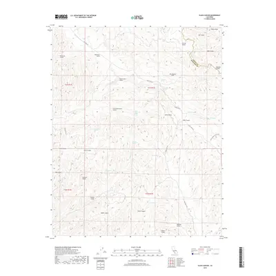
2018 Map of Slack Canyon
USGS Topo · Published 2018About this map
The San Andreas Fault cuts a visible path through this portion of the Diablo Range, defining the tectonic character of the borderlands between Monterey and Fresno counties. The landscape is characterized by a series of parallel valleys and canyons, most notably Peachtree Valley and Indian Valley, which follow the northwest-southeast grain of the fault system. This 2018 survey reveals a terrain defined by its water sources, where numerous named springs such as Little Bitterwater Spring, Buckeye Spring, and Splitrock Spring provide vital points of interest in an otherwise arid environment.
Find a feature on this map
47 named features on this map. Tap any name to fly to it.
Don’t see what you’re looking for? This feature index may not catch every label — zoom into the map to look around manually.
Map Details
Editions of this 2018 Slack Canyon Map
This is the sole edition of this map. No revisions or reprints were ever made.
Other maps of this area

1915 · Priest Valley
USGS Topo · 1:125,000

1919 · San Miguel
USGS Topo · 1:62,500

1919 · Bradley
USGS Topo · 1:62,500

1941 · Priest Valley
USGS Topo · 1:62,500

1941 · San Ardo
USGS Topo · 1:62,500

1941 · Bradley
USGS Topo · 1:62,500

1943 · San Ardo
USGS Topo · 1:62,500

1944 · Priest Valley
USGS Topo · 1:62,500

1947 · San Luis Obispo
USGS Topo · 1:250,000

1947 · San Miguel
USGS Topo · 1:62,500