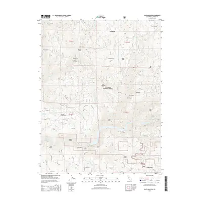
2015 Map of Slate Mountain
USGS Topo · Published 2015About this map
Eldorado National Forest encompasses much of this landscape, where the deeply incised canyons of the South Fork American River and its tributaries define the regional layout. The map documents several small mountain settlements, including Cedar Grove and Fairbanks, alongside locations with deep timber and mining history such as Pino Grande and Old Pino. The terrain is characterized by sharp relief, featuring prominent heights like Slate Mountain and Sand Mtn, as well as significant water management features including Finnon Reservoir and the Slab Cr Reservoir. The presence of Swansboro Country Airport reflects the modernization of transportation in this pocket of the Sierra Nevada foothills. Local road networks like Mosquito Rd and Fruit Ridge Rd provide access to residential clusters at Iowa Hill and Soapweed, showing how contemporary land use follows the contours of the historic gold-country geography.
Find a feature on this map
87 named features on this map. Tap any name to fly to it.
Don’t see what you’re looking for? This feature index may not catch every label — zoom into the map to look around manually.
Map Details
Editions of this 2015 Slate Mountain Map
This is the sole edition of this map. No revisions or reprints were ever made.
Other maps of this area

1891 · Placerville
USGS Topo · 1:125,000

1892 · Placerville
USGS Topo · 1:125,000

1893 · Placerville
USGS Topo · 1:125,000

1947 · Sacramento
USGS Topo · 1:250,000

1948 · Sacramento
USGS Topo · 1:250,000

1949 · Georgetown
USGS Topo · 1:62,500

1949 · Placerville
USGS Topo · 1:62,500
1949 · Georgetown
USGS Topo · 1:24,000

1949 · Placerville
USGS Topo · 1:24,000
1949 · Garden Valley
USGS Topo · 1:24,000