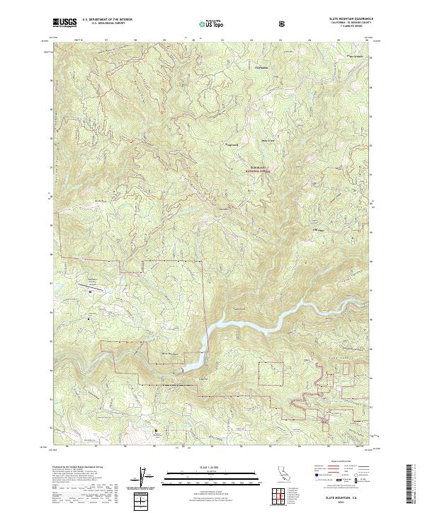
2021 Map of Slate Mountain
USGS Topo · Published 2021About this map
The South Fork American River carves through the heart of the Eldorado National Forest in this topographic study, revealing a landscape defined by deep canyons and high ridges. The map highlights several early mountain settlements and points of interest, including Pino Grande, Fairbanks, and Old Pino. For those researching local history, the Nelsonville Cem and Blairs-Winkelman Cem provide essential genealogical landmarks. The terrain is crisscrossed by an extensive network of fire roads and trails such as Mosquito Rd and the Rock Creek Loop Trl, which connect remote outposts like Deer View and Soapweed. The intricate drainage system, featuring names like Sailor Ravine and Dark Canyon, illustrates the complex hydrology that feeds the Larsen Reservoir and Mill Pond.
Find a feature on this map
105 named features on this map. Tap any name to fly to it.
Don’t see what you’re looking for? This feature index may not catch every label — zoom into the map to look around manually.
Map Details
Editions of this 2021 Slate Mountain Map
This is the sole edition of this map. No revisions or reprints were ever made.
Other maps of this area

1891 · Placerville
USGS Topo · 1:125,000

1892 · Placerville
USGS Topo · 1:125,000

1893 · Placerville
USGS Topo · 1:125,000

1947 · Sacramento
USGS Topo · 1:250,000

1948 · Sacramento
USGS Topo · 1:250,000

1949 · Georgetown
USGS Topo · 1:62,500

1949 · Placerville
USGS Topo · 1:62,500
1949 · Georgetown
USGS Topo · 1:24,000

1949 · Placerville
USGS Topo · 1:24,000
1949 · Garden Valley
USGS Topo · 1:24,000