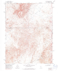
1972 Map of Slate Mtn
USGS Topo · Published 1990About this map
Slate Mountain anchors this high-desert landscape in the early 1970s, where several counties—Churchill, Mineral, and Nye—converge. The area is defined by its extraction history, evidenced by workings such as the Slate Mine, Eagleville Mine, and King Mine scattered among the peaks and canyons. This part of the Monte Cristo Mountains reveals a network of Jeep Trails navigating between high summits like Mt Anna and the broad, arid stretches of Bell Flat. The topography shows a distinct shift from the steep mineralized slopes to the low-lying Sand Dunes near the southern boundary. These labels represent a transitional era in Nevada mining, where older claims were being re-examined by a new generation of prospectors utilizing motorized access across the complex desert floor.
Find a feature on this map
15 named features on this map. Tap any name to fly to it.
Don’t see what you’re looking for? This feature index may not catch every label — zoom into the map to look around manually.
Map Details
Editions of this 1972 Slate Mtn Map
2 editions found
Other maps of this area

1908 · Carson Sink
USGS Topo · 1:250,000

1909 · Hawthorne
USGS Topo · 1:250,000

1910 · Carson Sink
USGS Topo · 1:250,000

1911 · Hawthorne
USGS Topo · 1:250,000

1915 · Hawthorne
USGS Topo · 1:250,000

1948 · Walker Lake
USGS Topo · 1:250,000

1957 · Walker Lake
USGS Topo · 1:250,000

1957 · Reno
USGS Topo · 1:250,000

1959 · Reno
USGS Topo · 1:250,000

1960 · Reno
USGS Topo · 1:250,000