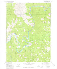
1980 Map of Slater Butte
USGS Topo · Published 1980About this map
Klamath River defines the geography of this Siskiyou County landscape, winding through the Klamath National Forest past historical gold-mining sites and small river settlements. The map documents a transition in land use, showing active infrastructure like the Slater Lookout Radio Towers alongside numerous historical mining sites. Prominent river bends are anchored by geographic features such as China Point, Williams Point, and Morgan Point, each associated with the region's extractive history.
Find a feature on this map
59 named features on this map. Tap any name to fly to it.
Don’t see what you’re looking for? This feature index may not catch every label — zoom into the map to look around manually.
Map Details
Editions of this 1980 Slater Butte Map
This is the sole edition of this map. No revisions or reprints were ever made.
Other maps of this area

1914 · Seiad
USGS Topo · 1:125,000

1922 · Seiad
USGS Topo · 1:125,000

1948 · Weed
USGS Topo · 1:250,000

1950 · Weed
USGS Topo · 1:250,000

1955 · Seiad Valley
USGS Topo · 1:62,500

1955 · Ukonom Lake
USGS Topo · 1:62,500

1955 · Scott Bar
USGS Topo · 1:62,500

1956 · Happy Camp
USGS Topo · 1:62,500

1958 · Weed
USGS Topo · 1:250,000

1963 · Weed
USGS Topo · 1:250,000