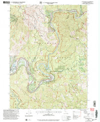
2001 Map of Slater Butte
USGS Topo · Published 2004About this map
The Klamath Wild and Scenic River snakes through this Siskiyou County landscape, defining the topography from Fort Goff down to the settlement of Happy Camp. This early 21st-century revision of older surveys captures a region deeply marked by its mineral history and the management of the Klamath National Forest. Along the river's winding course, named points like Morgan Point and Woods Bar sit near evidence of historical extraction, including the Muck a Muck Mine (Site) and Williams Point Mine (Site). High above the canyon, the Slater Butte Lookout Comm Towers stands as a sentinel over Fryingpan Ridge. The map details the transition from river-level access points to the high peaks of Cade Mountain and China Peak, providing a clear view of the rugged Klamath Mountains' industrial and recreational geography.
Find a feature on this map
53 named features on this map. Tap any name to fly to it.
Don’t see what you’re looking for? This feature index may not catch every label — zoom into the map to look around manually.
Map Details
Editions of this 2001 Slater Butte Map
This is the sole edition of this map. No revisions or reprints were ever made.
Other maps of this area

1914 · Seiad
USGS Topo · 1:125,000

1922 · Seiad
USGS Topo · 1:125,000

1948 · Weed
USGS Topo · 1:250,000

1950 · Weed
USGS Topo · 1:250,000

1955 · Seiad Valley
USGS Topo · 1:62,500

1955 · Ukonom Lake
USGS Topo · 1:62,500

1955 · Scott Bar
USGS Topo · 1:62,500

1956 · Happy Camp
USGS Topo · 1:62,500

1958 · Weed
USGS Topo · 1:250,000

1963 · Weed
USGS Topo · 1:250,000