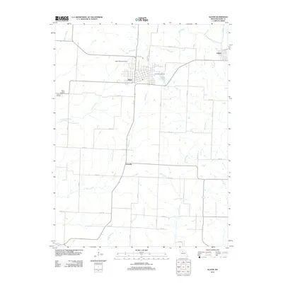
2012 Map of Slater
USGS Topo · Published 2012About this map
Slater serves as the central hub of this Saline County agricultural landscape, surrounded by a complex network of county roads and drainage systems. The town's grid is bounded to the north by the Slater Memorial Airport and to the east by Slater Lake, which is controlled by the Only Way Lake Dam. This 2012 survey illustrates a region defined by its watercourses, where the Thrailkill Branch and Rock Creek flow through the rural township towards the smaller settlements of Orearville and Gilliam. Local history is anchored by the Mount Horeb Cemetery and Hickman Cemetery located west of the main town site. The map provides a contemporary view of the intersection of rural infrastructure and the natural topography of the Missouri interior, showing how modern county routes like Co RD-134 and Co RD-15 stitch together these historically established farm communities.
Find a feature on this map
33 named features on this map. Tap any name to fly to it.
Don’t see what you’re looking for? This feature index may not catch every label — zoom into the map to look around manually.
Map Details
Editions of this 2012 Slater Map
This is the sole edition of this map. No revisions or reprints were ever made.
Other maps of this area

1890 · Glasgow
USGS Topo · 1:125,000

1890 · Marshall
USGS Topo · 1:125,000

1892 · Marshall
USGS Topo · 1:125,000

1901 · Marshall
USGS Topo · 1:125,000

1940 · Marshall
USGS Topo · 1:62,500

1944 · Marshall
USGS Topo · 1:62,500

1947 · Glasgow
USGS Topo · 1:62,500

1951 · Miami
USGS Topo · 1:24,000
1951 · New Frankfort
USGS Topo · 1:24,000

1953 · Moberly
USGS Topo · 1:250,000