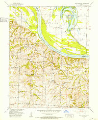
1951 Map of New Frankfort
USGS Topo · Published 1952About this map
The Missouri River forms the central artery of this landscape, dividing the bottomlands of Brunswick from the upland ridges of Cambridge. This mid-century survey documents a dense network of rural infrastructure, where small school districts and cemeteries were the primary anchors of the community. Named landmarks such as Garnett Sch, Good Luck Sch, and Walker Sch appear alongside family-associated burial grounds like Sleyster Cem. The topography reveals the complex hydrology of the river basin, featuring the Cut-off and Bowling Green Lake in the north, while the southern terrain is defined by deeply carved drainages like Edmondson Creek and Buck Creek. The small settlement of New Frankfort sits on the eastern bluffs, serving as a focal point for the surrounding homesteads and small-scale farms that characterized Saline County in the early 1950s.
Find a feature on this map
25 named features on this map. Tap any name to fly to it.
Don’t see what you’re looking for? This feature index may not catch every label — zoom into the map to look around manually.
Map Details
Editions of this 1951 New Frankfort Map
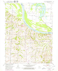
2 editions found
Other maps of this area

1890 · Glasgow
USGS Topo · 1:125,000

1890 · Marshall
USGS Topo · 1:125,000

1892 · Marshall
USGS Topo · 1:125,000

1901 · Marshall
USGS Topo · 1:125,000

1940 · Marshall
USGS Topo · 1:62,500

1944 · Marshall
USGS Topo · 1:62,500

1947 · Glasgow
USGS Topo · 1:62,500

1951 · Miami
USGS Topo · 1:24,000

1951 · Brunswick West
USGS Topo · 1:24,000

1951 · Brunswick East
USGS Topo · 1:24,000