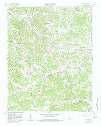
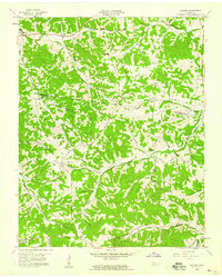
1958 Map of Slayden
USGS Topo · Published 1983About this map
The boundary between Montgomery Co Dickson Co bisects this hilly terrain, where small agrarian settlements and family cemeteries define the rural character of the mid-20th century. The village of Slayden serves as a central point, surrounded by numerous burial grounds like Groves Cem and Schmittou Cem that reveal the deep genealogical roots of the area. Transportation is largely defined by the historical path of the Old RR Grade and the winding course of Little Bartons Creek.
Find a feature on this map
45 named features on this map. Tap any name to fly to it.
Don’t see what you’re looking for? This feature index may not catch every label — zoom into the map to look around manually.
Map Details
Editions of this 1958 Slayden Map
2 editions found
Other maps of this area

1931 · Erin
USGS Topo · 1:62,500

1936 · Ruskin
USGS Topo · 1:24,000
1953 · Ruskin
USGS Topo · 1:24,000

1956 · Nashville
USGS Topo · 1:250,000

1958 · Charlotte
USGS Topo · 1:24,000

1958 · Cumberland Furnace
USGS Topo · 1:24,000
1958 · Vanleer
USGS Topo · 1:24,000
1958 · Palmyra
USGS Topo · 1:24,000
1958 · Slayden
USGS Topo · 1:24,000
1958 · Excell
USGS Topo · 1:24,000