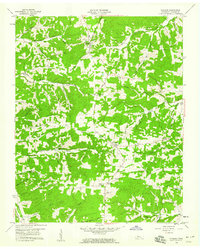
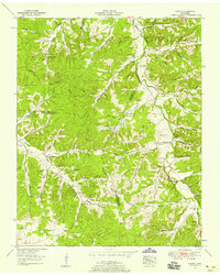
1958 Map of Vanleer
USGS Topo · Published 1959About this map
Vanleer serves as the central hub of this Dickson County landscape during the late 1950s, anchoring a network of rural roads and ridges. The terrain is defined by a dense system of hollows, including Smith Hollow, Black John Hollow, and Freeman Hollow, which reveal the traditional settlement patterns of Middle Tennessee. Along Sylvia Road and the surrounding hills, a remarkable concentration of family cemeteries like Baggett Cem, Edwards Cem, and Richardson Cem provides a significant record for genealogical research, often situated near crossroads communities like Taylor Crossroads and Sylvia.
Find a feature on this map
60 named features on this map. Tap any name to fly to it.
Don’t see what you’re looking for? This feature index may not catch every label — zoom into the map to look around manually.
Map Details
Editions of this 1958 Vanleer Map
3 editions found
Other maps of this area

1931 · Erin
USGS Topo · 1:62,500

1936 · Ruskin
USGS Topo · 1:24,000

1936 · Burns
USGS Topo · 1:24,000

1936 · Tennessee City
USGS Topo · 1:24,000

1936 · Dickson
USGS Topo · 1:24,000

1953 · Dickson
USGS Topo · 1:24,000
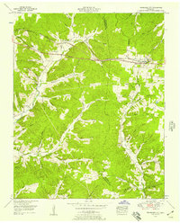
1953 · Tennessee City
USGS Topo · 1:24,000

1953 · Burns
USGS Topo · 1:24,000
1953 · Ruskin
USGS Topo · 1:24,000

1956 · Nashville
USGS Topo · 1:250,000