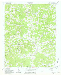
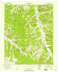
1958 Map of Vanleer
USGS Topo · Published 1981About this map
Vanleer and its surrounding countryside in Dickson County are captured here in the late 1950s, revealing a landscape defined by deeply incised hollows and a network of rural ridge roads. The topography is dominated by dramatic drainage patterns like Black John Hollow and Bell Hollow, while the settlement at Taylor Crossroads serves as a local waypoint between the larger creeks. Genealogists will find a high density of small family and community burial grounds, including the Fraudenthal Cem near Berry and the Nichols Cem in the north. Transport routes follow the contours of the land, with Stage Road and Maysville Road connecting the scattered farmsteads. The presence of multiple towers, such as the Lookout Tower near Hortense, suggests the elevation of these ridges was strategically significant for forest management or communication during this era.
Find a feature on this map
65 named features on this map. Tap any name to fly to it.
Don’t see what you’re looking for? This feature index may not catch every label — zoom into the map to look around manually.
Map Details
Editions of this 1958 Vanleer Map
3 editions found
Other maps of this area

1931 · Erin
USGS Topo · 1:62,500

1936 · Ruskin
USGS Topo · 1:24,000

1936 · Burns
USGS Topo · 1:24,000

1936 · Tennessee City
USGS Topo · 1:24,000

1936 · Dickson
USGS Topo · 1:24,000

1953 · Dickson
USGS Topo · 1:24,000
1953 · Tennessee City
USGS Topo · 1:24,000

1953 · Burns
USGS Topo · 1:24,000
1953 · Ruskin
USGS Topo · 1:24,000

1956 · Nashville
USGS Topo · 1:250,000