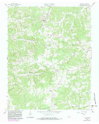
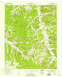
1958 Map of Vanleer
USGS Topo · Published 1983About this map
Vanleer and Sylvia anchor this rural Tennessee landscape, which is defined by a dense network of winding hollows and creek branches. The terrain is deeply etched by Yellow Creek and Bartons Creek, where numerous family-named cemeteries such as Nichols Cem, Walker Cem, and Felt Cem suggest a long-established pattern of generational settlement. These small graveyards are tucked into the ridges and valleys, often near historic routes like Maysville Road and Stage Road.
Find a feature on this map
56 named features on this map. Tap any name to fly to it.
Don’t see what you’re looking for? This feature index may not catch every label — zoom into the map to look around manually.
Map Details
Editions of this 1958 Vanleer Map
3 editions found
Other maps of this area

1931 · Erin
USGS Topo · 1:62,500

1936 · Ruskin
USGS Topo · 1:24,000

1936 · Burns
USGS Topo · 1:24,000

1936 · Tennessee City
USGS Topo · 1:24,000

1936 · Dickson
USGS Topo · 1:24,000

1953 · Dickson
USGS Topo · 1:24,000
1953 · Tennessee City
USGS Topo · 1:24,000

1953 · Burns
USGS Topo · 1:24,000
1953 · Ruskin
USGS Topo · 1:24,000

1956 · Nashville
USGS Topo · 1:250,000