
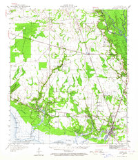
1950 Map of Slidell
USGS Topo · Published 1962About this map
Lake Pontchartrain defines the southern boundary of this coastal parish landscape, where the intricate network of the West Pearl River and Pearl River delta dominates the eastern border. This mid-century revision captures the region during a period of transition, showing the expansion of Slidell and North Slidell alongside established rail routes like the Gulf Mobile and Ohio and the Southern railroad. The map preserves the location of rural community centers such as Hickory and Florenville, as well as several smaller hamlets like St Tammany Corner and Alton. In the west, the St Tammany State Game Forest and State Game Refuge protect the wetlands near Goose Point. Cultural landmarks including the Forest Glen School, Peace Grove Church, and Parker Cem provide essential data for those tracing local family history and the development of the Piney Woods and bayou communities.
Find a feature on this map
69 named features on this map. Tap any name to fly to it.
Don’t see what you’re looking for? This feature index may not catch every label — zoom into the map to look around manually.
Map Details
Editions of this 1950 Slidell Map
2 editions found
Other maps of this area

1891 · Spanish Fort
USGS Topo · 1:62,500

1892 · Chef Menteur
USGS Topo · 1:62,500

1893 · Rigolets
USGS Topo · 1:62,500

1914 · Nicholson
USGS Topo · 1:62,500

1921 · Nicholson
USGS Topo · 1:62,500

1935 · Slidell
USGS Topo · 1:62,500

1935 · Covington
USGS Topo · 1:62,500

1936 · North Shore
USGS Topo · 1:31,680

1936 · South Point
USGS Topo · 1:31,680

1936 · Chef Menteur
USGS Topo · 1:62,500